 Hi Boox Popular Magazine 2024
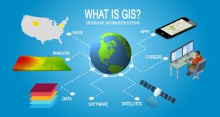
Mapping can be done in a myriad of ways, but one of the most popular is Geographic Information Systems (GIS). GIS software is used to create accurate, up-to-date maps of physical spaces. This includes everything from mapping roads and buildings to tracking pests and vegetation. It can be used for …
Read More »How GIS can be used for mapping – what tools are used?